

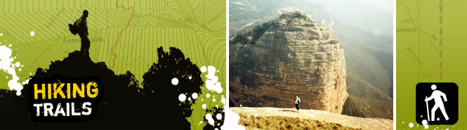
Hiking trails through Guara in Aragón
The Sierra and Canyons of Guara Natural Park, with its spectacular rocky cliffs carved out by water, offer a multitude of breathtaking landscapes accessible along marked trails: the Mascún ravine, the crests of Balced, the natural springs of La Tamara and Puntillo, Vero Canyon, La Cunarda, etc.
Thanks to this network of signposted routes, the environs of Bierge, Rodellar, Alquézar and Colungo can be explored to reveal unique landscapes, gorges teeming with flora and fauna, cave paintings, towers and crenellated walls, shrines, traditional architecture, and the legends of maidens, ghosts and Moors.
Recommended walking routes in the region of Somontano:
- Alquézar: From Alquézar to Asque
- Alquézar: Chimiachas Route
- Alquézar: The walkways or La Fuente ravine route
- Rodellar: Route along the crest of Balced
- Rodellar: The shrine of La Virgen del Castillo route
- Rodellar: El Real de Mascún: from Rodellar to Otín
- Colungo: Cave paintings
 Alquézar: From Alquézar to Asque
Circular route.
Start point: church of San Miguel (Alquézar) / church of Santa Columba (Asque).
Grade:easy
Duration: 4 hours.
Recommendations: Take sturdy footwear and water.
Points of interest: homemade honey, the church of Santa Columba and the Guadamacil Museum in Asque, Villacantal
bridge, Fuendebaños bridge, numerous vantage points, the remains of dams, irrigation channels and mills on the Vero river.
Alquézar: Chimiachas route
Linear route.
Start point: the stone shelter by La Baseta (Alquézar).
Grade: easy.
Duration: 6 hours.
Recommendations: take sturdy footwear and water.
Points of interest: vantage point at Las Clusas (views of the sierras and the Vero canyon), the pools at Basacol, the caves at Quizans, the small cave in Chimiachas ravine.
Alquézar: The walkways or La Fuente ravine route
Circular route.
Start point: by the Plaza Mayor (Alquézar).
Grade: easy.
Duration: 1 hour 30 minutes.
Recommendations: Take sturdy footwear and water.
Points of interest: the Vero canyon, the remains of dams, irrigation channels and mills on the Vero river, Fuendebaños
bridge..
Rodellar: Route along the crest of Balced
Linear route.
Start point: the HU-341 road from Las Almunias de Rodellar or from Rodellar.
Grade: easy (drop in ground level of 650 metres).
Duration: 4 hours.
Recommendations: Water and suitable footwear for rocky areas.
Points of interest: views of the Pyrenees, the sierras and the ravines of Guara.
Rodellar: The shrine of La Virgen del Castillo route
Circular route.
Start point: the entrance to the village (Rodellar).
Grade: easy (there is one sharp 100-metre climb).
Duration: 3 hours.
Recommendations: Take sturdy footwear and water.
Points of interest: traditional architecture, dry stone walls, Mediterranean woodland, the village of Cheto, Fonciachas
spring, the Romanesque shrine of la Virgen del Castillo, views of the Mascún.
Rodellar: El Real de Mascún: from Rodellar to Otín
Circular route.
Start point: Rodellar.
Grade: easy (drop in ground level of 480 metres).
Duration: 8 hours.
Recommendations: suitable footwear for rocky areas, take on water at Mascún natural spring.
Points of interest: Mascún natural spring, rock needles, the deserted village of Otín, the Romanesque church of Nasarre, the dolmen of Losa Mora.
Colungo: Cave paintings
Linear route.
Start point: A-2205 (cark park, 9 km from Colungo, in the direction of Arcusa).
Grade: easy.
Duration: 1 hour (the guided walk lasts 2 hours in total).
Recommendations: take sturdy footwear and water.
Points of interest: cave paintings.
Information provided by Tourism Somontano.
![]()
