

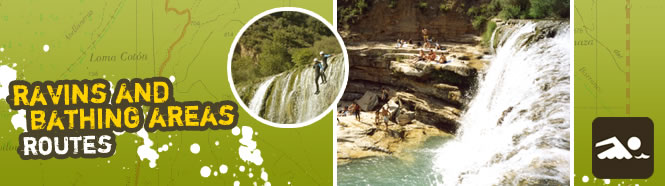
Ravines and bathing areas in the Sierra de Guara
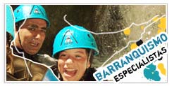
Thanks to the sheer variety of its descents, the Sierra de Guara is the true cradle of canyoning. Its more than 60 canyoning ravines vary greatly in length and require different levels of physical fitness and expertise, while offering a host of different landscapes and points of interest.
Anyone can have a go at this exciting sport but you will need to have a professional guide with you at all times, someone who knows the area inside out and with the necessary experience to deal with all the risks and dangers that the sport involves (sudden surges of water, falling rocks, etc).
Recommended bathing zones in the region of Somontano:
- Bierge: Alcanadre Basin. El Puntillo and La Tamara
- Alquézar: Vero Basin. Villacantal bridge-La Fuente ravine
- Rodellar: Alcanadre Basin. La Peonera - San Martín
- Rodellar: Isuala Basin. Tranco de las Olas
 Bierge: Alcanadre Basin. El Puntillo and La Tamara
Signposted linear route.
Start point: Car park at El Salto de Bierge.
Difficulty rating: easy-medium.
Approximate duration: 3 hours (there and back).
Getting there: 45 minutes to El Puntillo and 45 minutes
more to Fuente de la Tamara.
Coming back: 1 hour 30 minutes.
Recommendations:
Take sturdy footwear and water.
Spring and autumn are the best times of the year for enjoying this route.
In summer months you can follow the course of the river down from Fuente de la Tamara and wade along the left
bank at El Puntillo up to Bierge dam.
Alquézar: Vero Basin. Villacantal bridge-La Fuente ravine
Circular route.
Start point: Alquézar.
Difficulty rating: Moyenne.
Approximate duration: 2 hours.
Getting there: 45 minutes depuis Alquézar jusqu´au pont de Villacantal. 15 minutes de plus par la rivière jusqu´au ravin de la Fuente.
Coming back: 40 minutes du ravin de la Fuente à Alquézar.
Recommendations: Porter de bonnes chaussures et de l´eau.
Rodellar: Alcanadre Basin. La Peonera - San Martín
Circular signposted route.
Start point: Corral Alto, kilometre 9 on the HU-341 road from Bierge to Rodellar.
Difficulty rating: difficult, due to steep drop in ground level.
Approximate duration: 4 hours.
Getting there: 2 hours. Park your car at Corral Alto and walk along the track to the left of the road in the direction of Rodellar. At the end of the track you come to Los Corrales de San Juan and a magnifi cent natural vantage point. You can choose two paths here, leading to the shrine of San Martín and the potholes at Alcanadre: the path on the right is called Faja L’Ordio, and the one on the left is the Los Gradones Way.
Coming back: 2 hours.
Recommendations:
Take sturdy footwear and water.
In summer, and due to the steep terrain of the approach to the ravine, we advise taking the largely exposed Faja L’Ordio
down to the shrine, and taking Los Gradones Way as the uphill route, as it offers much more shade from the sun.
Rodellar: Isuala Basin. Tranco de las Olas
Linear route.
Start point: the hill at Barranco Fondo.
Difficulty rating: medium-easy A simple route with a drop of only 200 metres.
Approximate duration: 1 heure, 20 minutes
Getting there: 35 minutes. From the hill at Barranco Fondo, take the track that departs on the right (in the direction of Rodellar). After five minutes you come to the car park at Oscuros de Balced. Park your car there.
The route begins with a trail on the right that leads into a pine forest.
Coming back: 45 minutes.
Recommendations:
Take sturdy footwear, water and a hat.
Information provided by Tourism Somontano.
![]()
